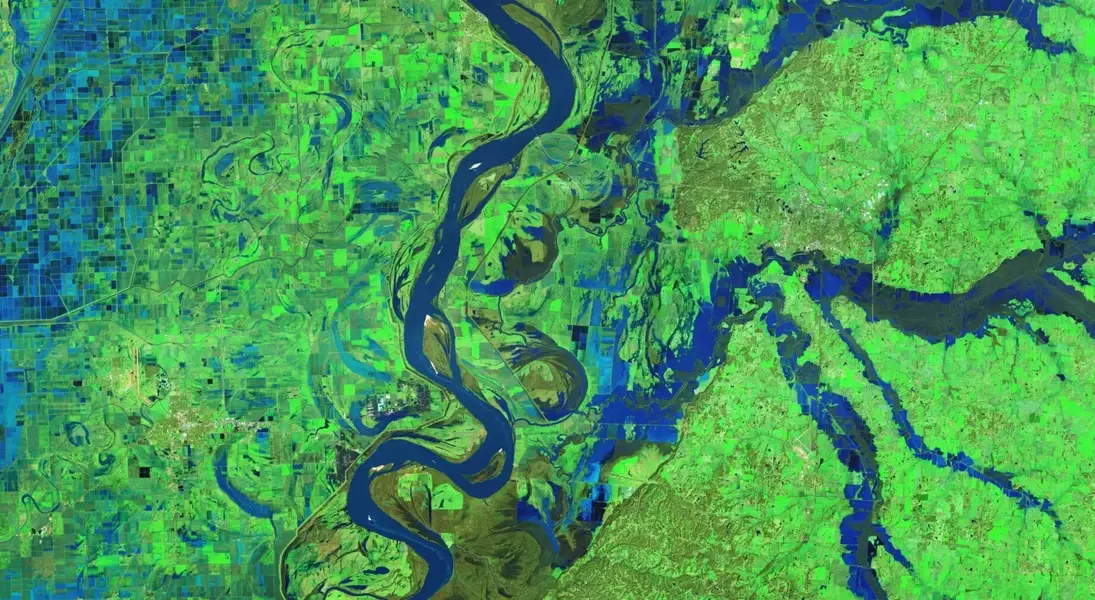
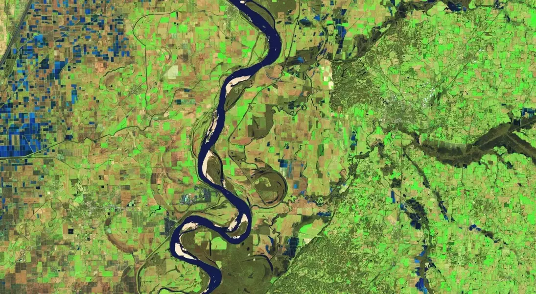
The weekend's powerful winter storm system brought unprecedented flooding to Tennessee and Kentucky, visible even from space through NASA satellite imagery. The Mississippi River and its tributaries overflowed, causing levee failures and prompting emergency declarations. Meanwhile, the broader East Coast faced severe winter weather advisories, with California experiencing mudslides.
Witness the Devastating Impact of Nature’s Fury on Communities Across the Region
Satellite Imagery Reveals Extent of Waterlogged Landscapes
NASA’s Operational Land Imager-2 (OLI-2) aboard Landsat 9 captured striking false-color images of western Tennessee on February 17. These images, employing specific color bands, vividly differentiate between water, land, and vegetation. The Mississippi River, winding through western Tennessee, eastern Arkansas, and Missouri, is depicted in stark contrast against the inundated regions east of it. In Tennessee, rainfall exceeded six inches within a mere 48 hours, submerging vast areas under water. The Obion River, located in the top-right of these images, suffered a critical levee failure near Rives, leading to catastrophic flooding. The U.S. Geological Survey recorded a water level of 39.8 feet at Obion, well above the flood stage threshold of 34 feet. This data underscores the severity of the situation, highlighting the need for advanced monitoring systems and timely interventions.Regional Weather Disruptions Extend Beyond Flooding
The storm's impact was not confined to Tennessee and Kentucky; it cast a wide net across the East Coast. Over half of the states experienced winter weather advisories, while 11 states received flash flood warnings. California endured heavy rains that triggered dangerous mudslides, further complicating recovery efforts. In Kentucky, the situation was dire. Thirty flood warnings and 47 flash flood warnings were issued, alongside 11 severe thunderstorm warnings and two tornado warnings. Roads were closed en masse, and tens of thousands lost power. The National Weather Service reported that most of the rain fell on Valentine’s Day, with several river sites reaching their highest crests in recorded history. Hydrographs from affected rivers are available on the service’s website, providing valuable insights into the flood dynamics.Aftermath and Ongoing Challenges
Despite the initial deluge, challenges persist. Western Kentucky now faces flurries and snow showers, with temperatures barely rising above the lower 20s. Southeastern Illinois and southwestern Indiana are also bracing for snowy conditions days after the floods. The transition from one extreme to another highlights the unpredictable nature of weather patterns and the resilience required by communities.Cloud cover over northern Tennessee and Kentucky has prevented satellites from capturing the full extent of the damage there. However, anecdotal evidence and ground reports paint a grim picture of destruction and displacement. Recovery efforts are ongoing, with authorities emphasizing the importance of preparedness and community support.You May Like


